Description
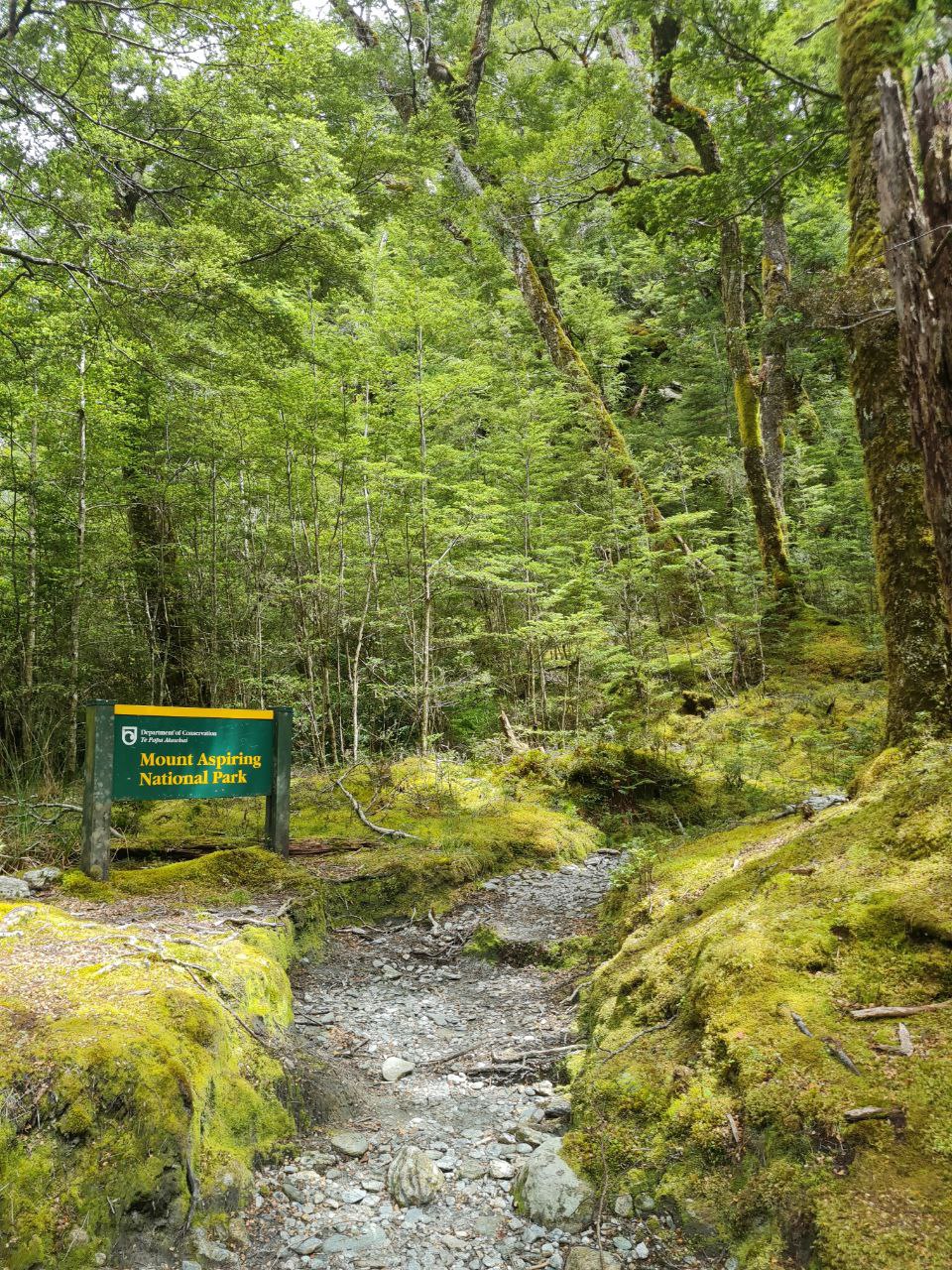
The Rees-Dart Track is a challenging multi-day circuit in Mount Aspiring National Park, linking the Rees and Dart river valleys at the head of Lake Wakatipu. The route covers approximately 95 km over six days, walked north to south from the Muddy Creek carpark near Glenorchy to Chinamans Bluff carpark via Paradise. The two trailheads are several kilometers apart on separate roads, so transport between them must be arranged before departure.
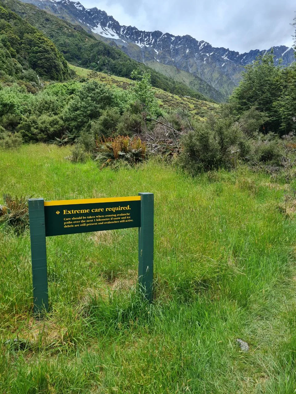
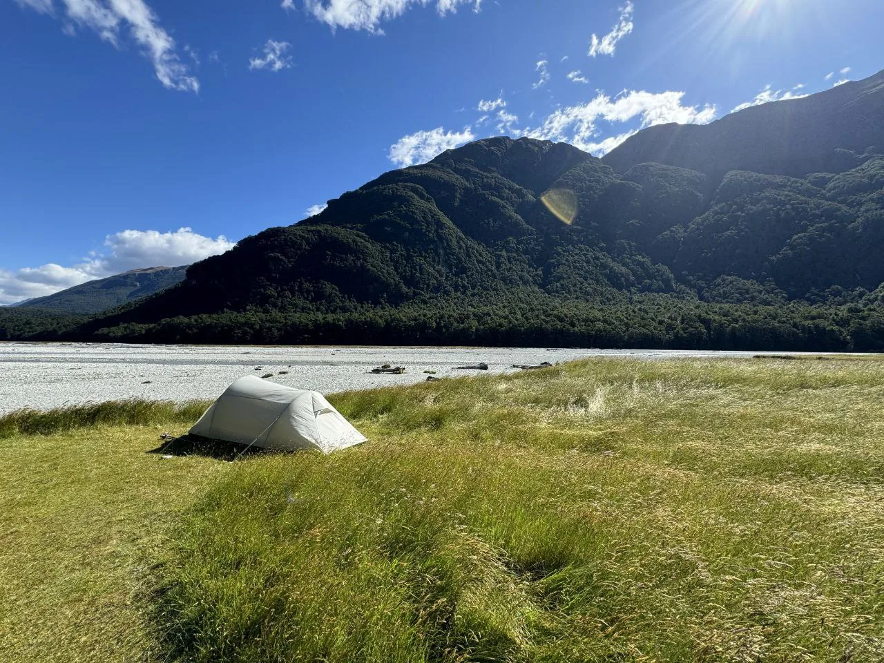
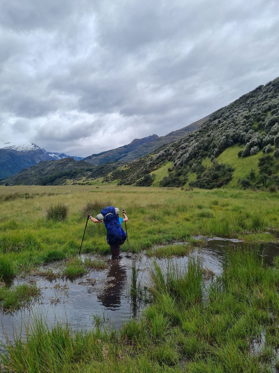
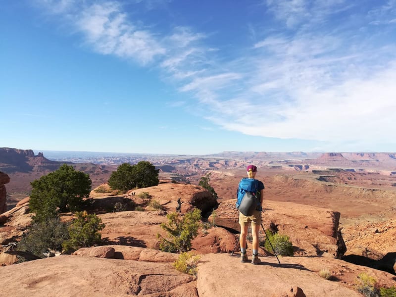
Day 1 covers 18.5 km with 551 m of ascent, following the Rees Valley upstream from around 524 m elevation through beech forest and broad river flats. Sections of persistently boggy ground occur regardless of recent weather, particularly around Arthur’s Creek and the approach to the Rees River swingbridge. On settled days, open river terraces of pale gray glacial gravel sit beside the hut campsite areas, with steep beech-forested valley walls on both sides. The day ends at Shelter Rock Hut, a 22-bunk serviced hut on the east bank of the Rees River. A DOC warning sign in the upper valley marks a kilometer of avalanche paths between the bushline and the hut, which can pose serious hazard outside the main summer window.
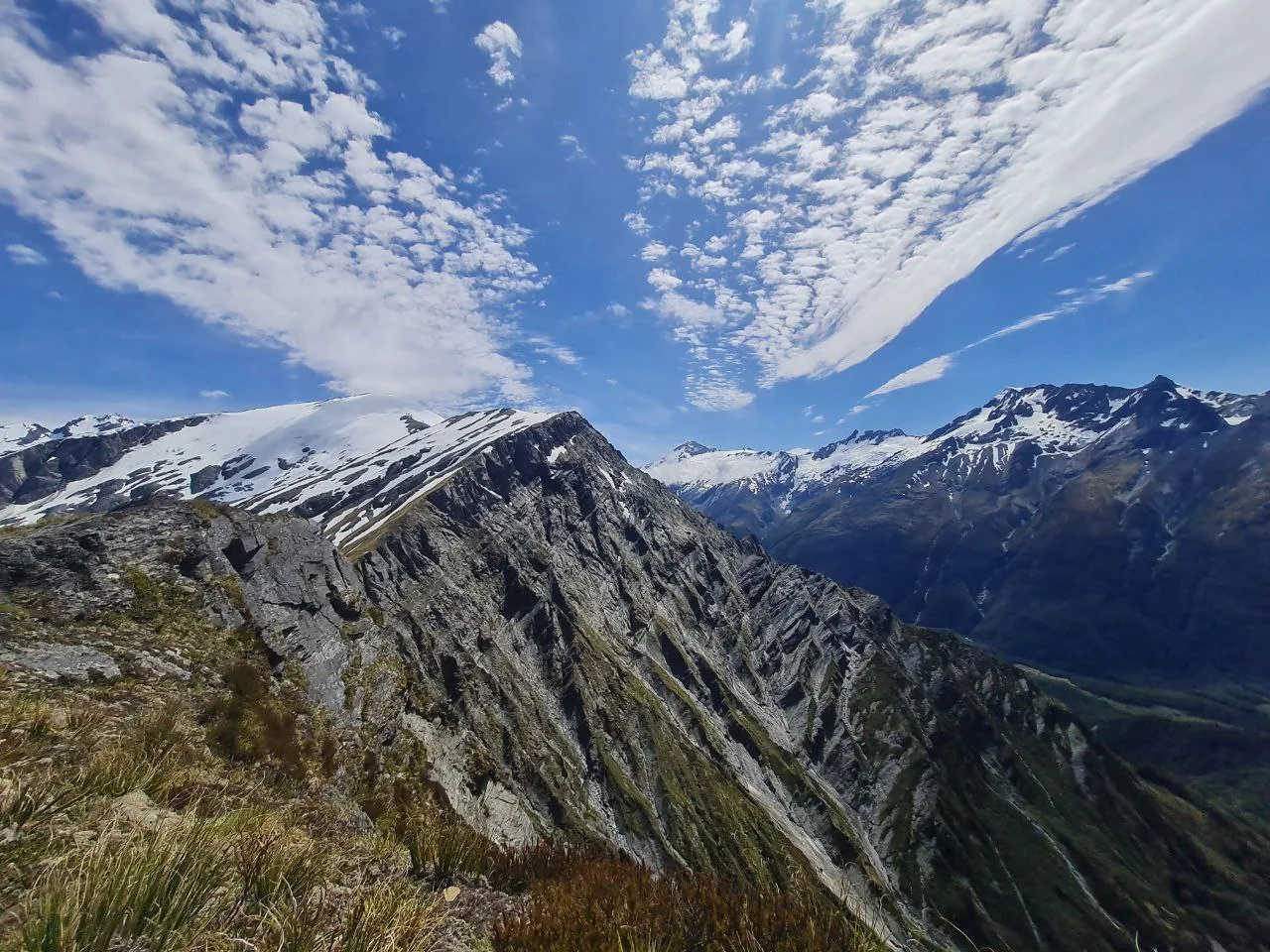
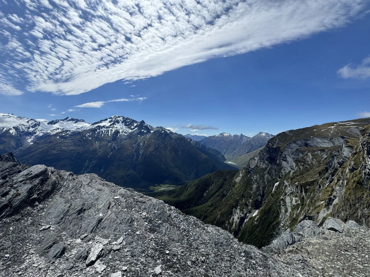
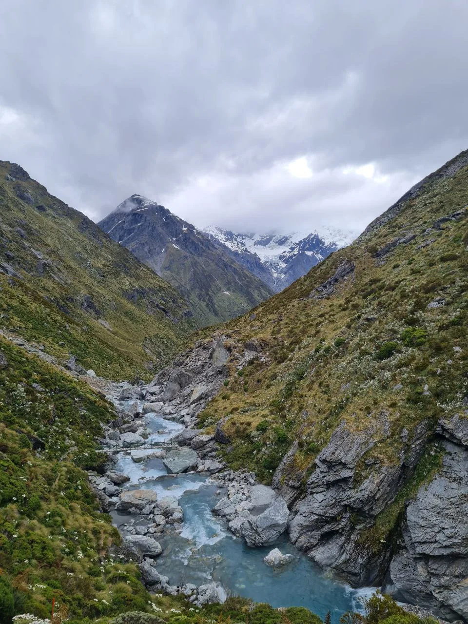
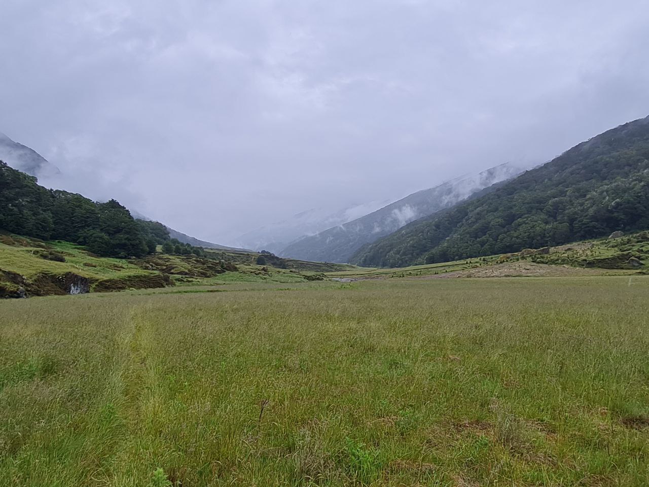
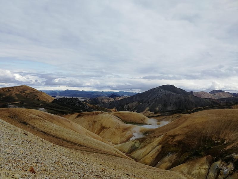
Day 2 covers 8.9 km with 646 m of ascent and 595 m of descent — the shortest day by distance but the most demanding. The track climbs through subalpine tussock and scree to Rees Saddle at 1,471 m. From the saddle, fractured lichen-spotted schist slabs give way to a view of the deep U-shaped Dart Valley below, the Dart River braiding through pale gravel flats between walls of montane beech forest, with snow-capped Main Divide peaks behind. The descent follows a marked route only — no formed track — dropping steeply above the Snowy Creek gorge with significant drop-offs and narrow ridgeline sections requiring careful foot placement, particularly when wet. Day 3 continues at 18.8 km with 753 m of ascent and 742 m of descent, working through open alpine terrain before dropping into beech forest and reaching Dart Hut.
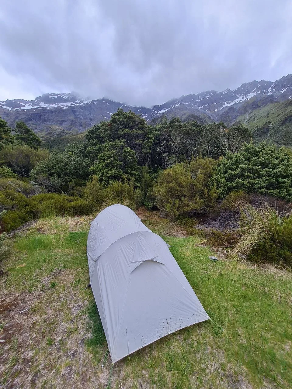
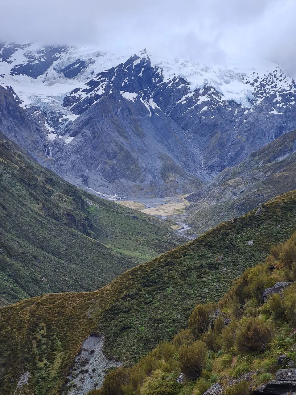
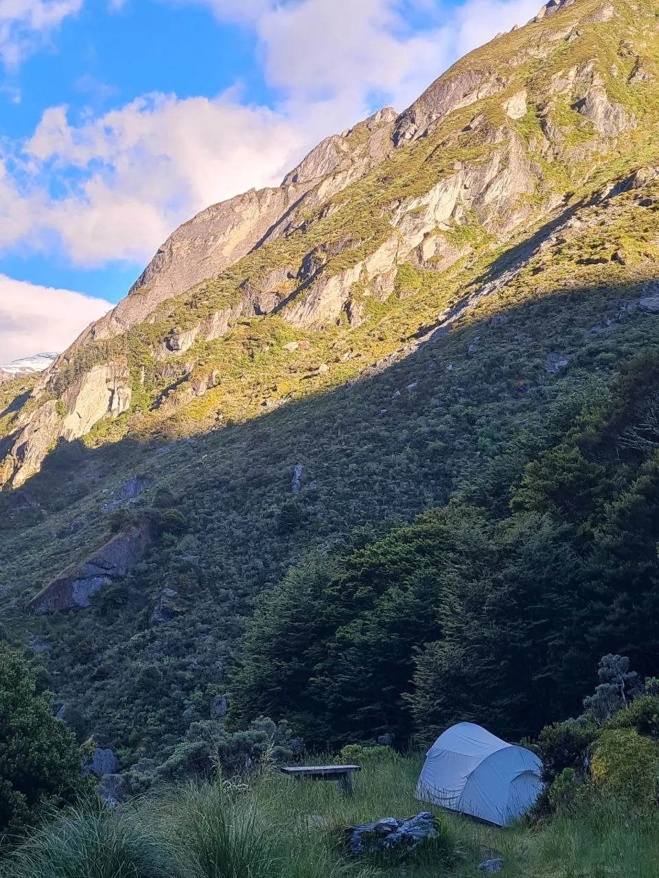
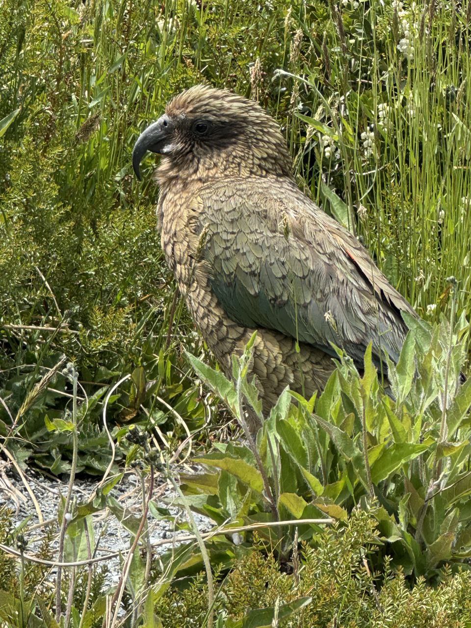
Dart Hut serves as a base for the Dart Glacier side trip, which follows the Dart River/Te Awa Whakatipu northward via marker poles and rock cairns. The approach moves through grey glacial moraine to the glacier’s heavily crevassed terminus, where seracs of blue-white ice descend through a narrow rocky gorge before widening into a broad snowfield. Many parties spend two nights at Dart Hut to complete this excursion. The campsite — low-profile tents on grassy flats beneath steep schist rock faces and mixed subalpine scrub — is exposed to weather. Kea are commonly heard throughout the upper Dart area — we heard them repeatedly on the trail to the glacier, and on the approach to the terminus they appeared at very close range, landing nearby and investigating gear with their characteristic curiosity. Kea will damage tents and gear left unattended.
Days 4 and 5 move progressively down the Dart Valley, covering 16.2 km and 15.8 km respectively. Day 4 descends 784 m with modest ascent, dropping through open river flats and beech forest toward Daleys Flat Hut. The glacially sourced Dart River runs turquoise-blue through boulder-choked gorges, white rapids alternating with calmer pools. A single-file swingbridge spans one such gorge. The lower valley supports yellowheads, kākā, robins, fantails, and Paradise ducks. Multiple stream crossings can become hazardous when river levels rise. Day 5 continues through similar terrain at lower elevation, with 417 m of ascent and 488 m of descent.
Day 6 covers 16.8 km with 263 m of ascent and 417 m of descent, ending at Paradise near Chinamans Bluff carpark through cattle flat and open ground. The road beyond Paradise to the carpark can flood after heavy rain, requiring trampers to walk from Paradise to meet transport. We spent one additional night camping near the car park at the end — a genuinely beautiful and quiet spot, a fitting finish to the route. There is no cell reception anywhere on the Rees-Dart Track.
What to bring
- Personal Locator Beacon (PLB) or satellite communicator — no cell reception exists anywhere on the track.
- Walking poles — useful on the boggy lower Rees sections, the steep Snowy Creek descent, and the Dart Valley stream crossings.
- Water treatment tablets or filter — hut water supplies are untreated and some sections pass near grazing land.
- Rodent-proof food storage containers — mice are present at campsites along the route.
- Tent with robust weatherproofing, particularly for the exposed Dart Hut campsite.
- Layered alpine clothing and full waterproofs for conditions at and above Rees Saddle.
- Dry bags or pack liner — boggy sections and river crossings will wet any unprotected pack.
Tips
- Arrange point-to-point transport before departure — shuttle services operate from Queenstown and Glenorchy to both trailheads. If leaving a vehicle at each end, confirm road conditions to Chinamans Bluff, as the road through Paradise floods.
- Confirm the Upper Snowy Creek bridge is in place before starting — it is removed outside the summer season and its absence makes the crossing between Shelter Rock Hut and Dart Hut impassable.
- Do not attempt flooded crossings in the Dart Valley; wait for levels to drop. Glacially fed streams surge quickly after rain and can look calmer than they are.
- Allow two nights at Dart Hut if the Dart Glacier side trip is on the itinerary — the return approach is a full day.
- Camping is prohibited in the alpine and subalpine zones between Shelter Rock Hut and Dart Hut — overnight stops must be at huts through this section.
- Secure all gear immediately on arrival in the upper Dart area — kea will investigate unattended tents and packs within minutes and can chew through fabric and carry off loose items.
Links
- DOC — Rees-Dart Track official page
- DOC — Rees-Dart Track brochure (PDF)
- Access Glenorchy — shuttle transport and trailhead road conditions
Downloads
Day 1 GPX Day 2 GPX Day 3 GPX Day 4 GPX Day 5 GPX Day 6 GPX