Description
The Pilgrimsleden Dalsland follows a medieval pilgrim route north toward Trondheim, where St. Olaf is buried. The Dalsland section runs from Vänersborg to Edsleskog near Åmål. We hiked the northern half, from Mellerud to Åmål, over four days in late August 2021.
The first day from Mellerud to Upperud is the gentlest. Country paths and gravel roads through farmland and patches of forest, past medieval churches. Upperud sits on the Dalsland Canal, a lakeside settlement with a lock and a café.
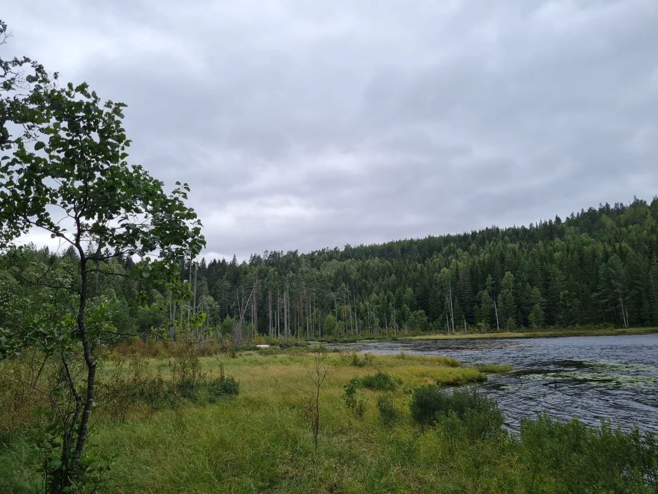
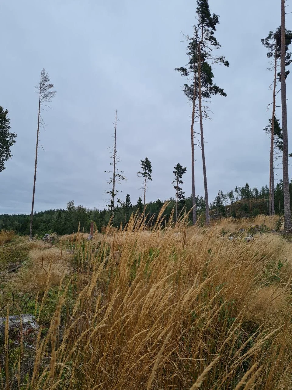
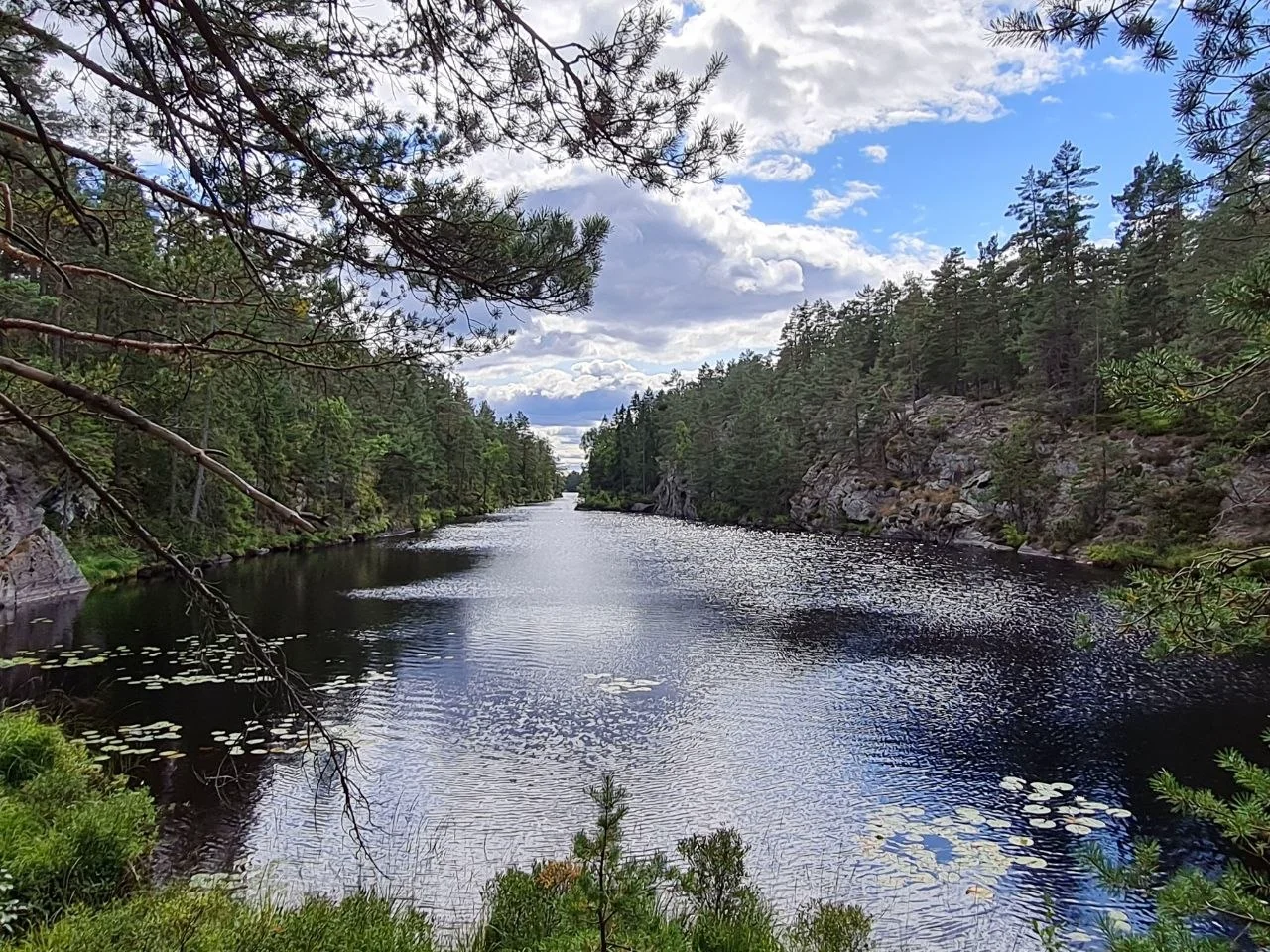
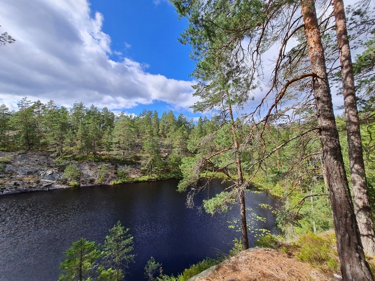
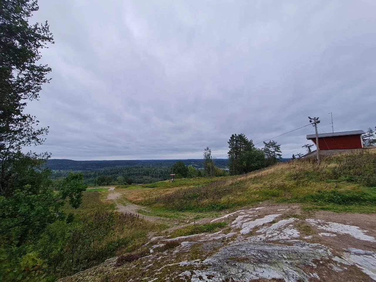
North of Upperud the forest gets denser and older. The terrain is more rugged, though the highest points barely exceed 200 m. The tourism board compares this section to Sweden’s High Coast. Lakes appear around every bend. Some have swimming spots, others are full of reeds and lily pads. The forest is pine, spruce, and birch, with blueberry bushes covering the ground in late summer. Day 2 included a short afternoon walk from Edsleskog, which shows up as a second segment in the GPX.
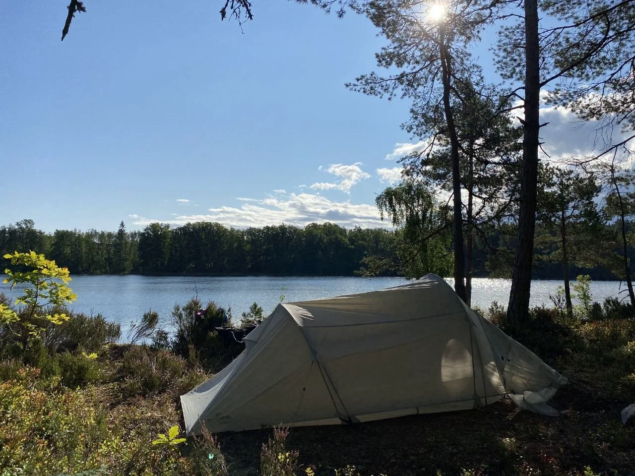
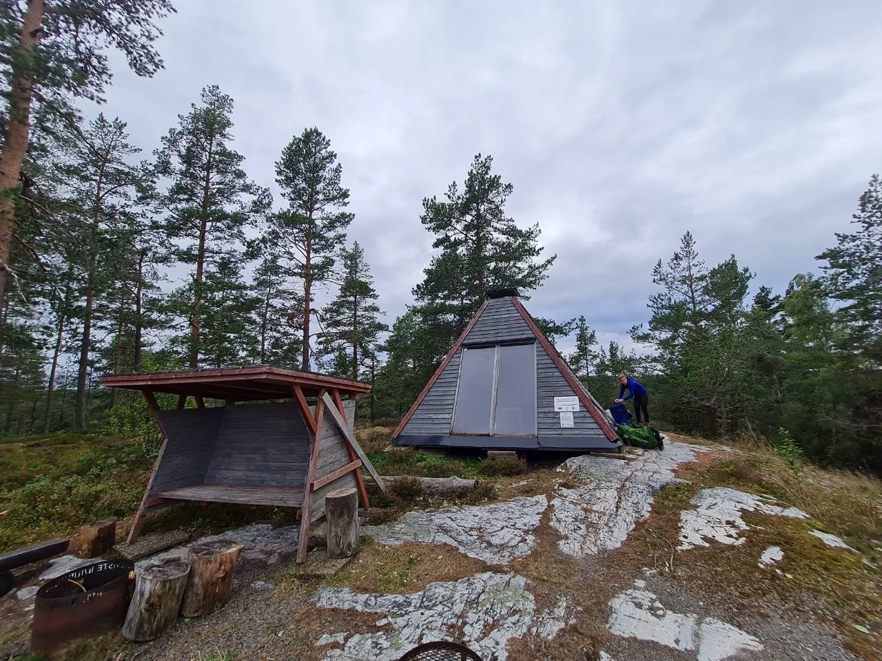
We slept in our tent most nights and used the trail’s wind shelters (vindskydd) for cooking and eating. The shelters are simple three-sided wooden structures with a roof and a fire pit. They are free and first-come, first-served. Sleeping in the tent was fine even in wind and rain, and it gave us more flexibility to camp by the lakes. We used a shelter for cooking when the wind picked up.
Late August was a good time for this trail. Weather was mostly fine, but already windy and cool at times. At 59°N the temperature drops quickly when the sun goes behind clouds, and the evenings are short. The forests were full of ripe berries. Bilberries (blåbär) everywhere, lingonberries starting to ripen, the occasional bog bilberry. We carried pancake mix and made blueberry pancakes on the stove, using fresh bilberries.
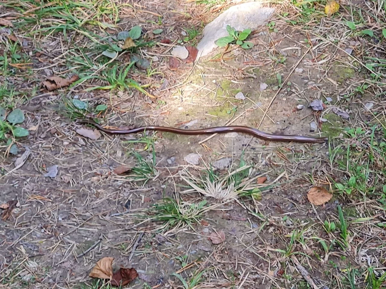
We saw a slowworm, a legless lizard often mistaken for a snake, sunning itself on the path. Sweden has three actual snake species: the adder (huggorm), grass snake (snok), and smooth snake. The adder is venomous but its bite is rarely dangerous to healthy adults. In late August snakes and slowworms are frequently seen basking in sunny spots. They are easy to spot and easy to avoid.
The final day from Höljedalen to Åmål is the longest at 25.6 km, mostly on forest paths and gravel roads. Åmål is a small town on Lake Vänern with a bus connection back to Mellerud. We had parked at the church in Mellerud at the start, so the return was straightforward.
Getting there
Mellerud has a train station with regular connections from Gothenburg (about 1.5 hours) via Vänersborg. If driving, park at the church near the trailhead in Mellerud. At the end of the hike in Åmål, take the bus back to Mellerud, 30 to 45 minutes. Bus timetables are available via Västtrafik.
Accommodation
The trail has several free wind shelters and rest cabins along the route:
- Livarebosjön Raststuga (58.842, 12.426) — rest cabin near Upperud
- Flat Vindskydd (58.877, 12.437) — wind shelter for sleeping
- Värnebo Vindskydd (58.966, 12.403) — wind shelter for sleeping
- Tansjön Vindskydd (58.989, 12.407) — wind shelter for sleeping
- Högelund Raststuga (58.921, 12.433) — rest cabin
- Koppungstjärnet Vindskydd (59.032, 12.433) — wind shelter for sleeping
- Högheden Övernattningsstuga (59.043, 12.444) — overnight cabin
All are first-come, first-served. Bring a tent or tarp as backup. There are no shops along the northern section, so carry all food for the duration of your hike.
What to bring
- Warm layers, even in August
- Rain gear
- Tent or tarp
- Sleeping bag and mat
- Cooking gear and stove
- Pancake mix and a small container for berries
- Map or GPS track
- Insect repellent, less of an issue in late August but still useful
Tips
- Berry season: Late August is ideal for foraging. Bilberries (blåbär) are the most abundant. Lingonberries (lingon) ripen slightly later.
- Blueberry pancakes: Mix pancake powder with water, fold in fresh bilberries, cook on a stove or over a fire.
- Tent vs shelter: We preferred the tent for sleeping and used shelters for cooking. Camping by the lakes gives you more options.
- Bus back: Check Västtrafik timetables in advance. The bus from Åmål to Mellerud runs on a limited schedule, especially on weekends.
Links
- The pilgrim path north Dalsland — Vastsverige.com
- Pilgrimsleden — Dalslandskanal.se
- Shelters along Pilgrimsleden Dalsland — Vindskyddskartan.se
- Cesar’s Guide to Pilgrimsleden Dalsland
- Old churches and dense forests — Komoot Collection
- Snakes in Sweden — Forest Junkie
Downloads
- Day 1: Mellerud to Upperud
- Day 2: Upperud to Edsleskog
- Day 3: Edsleskog to Höljedalen
- Day 4: Höljedalen to Åmål