Description
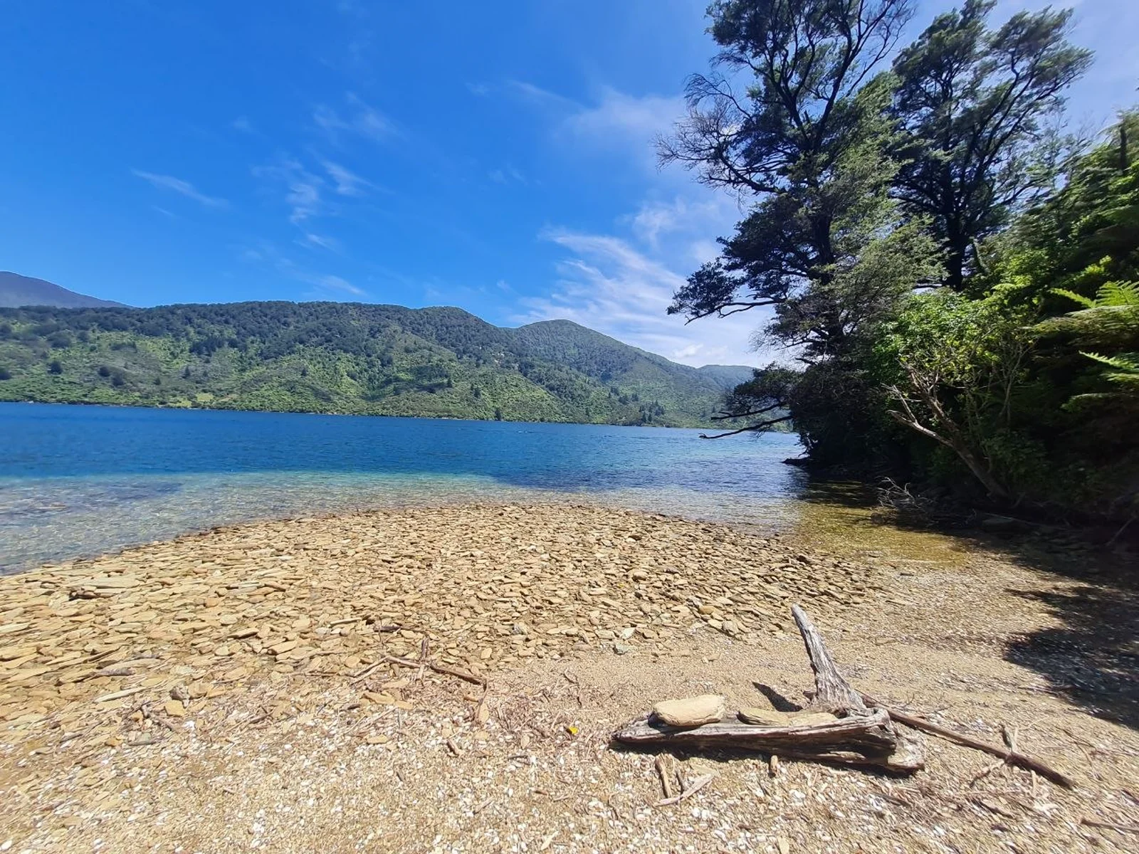
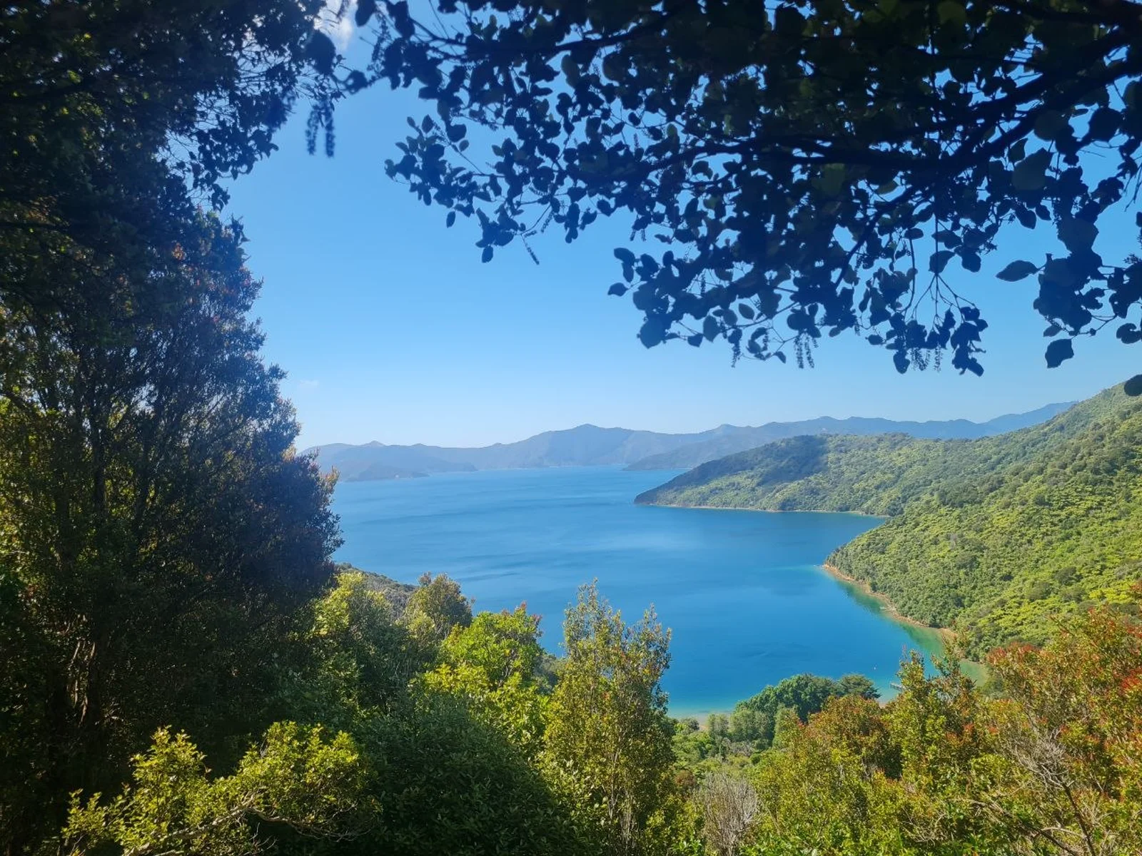
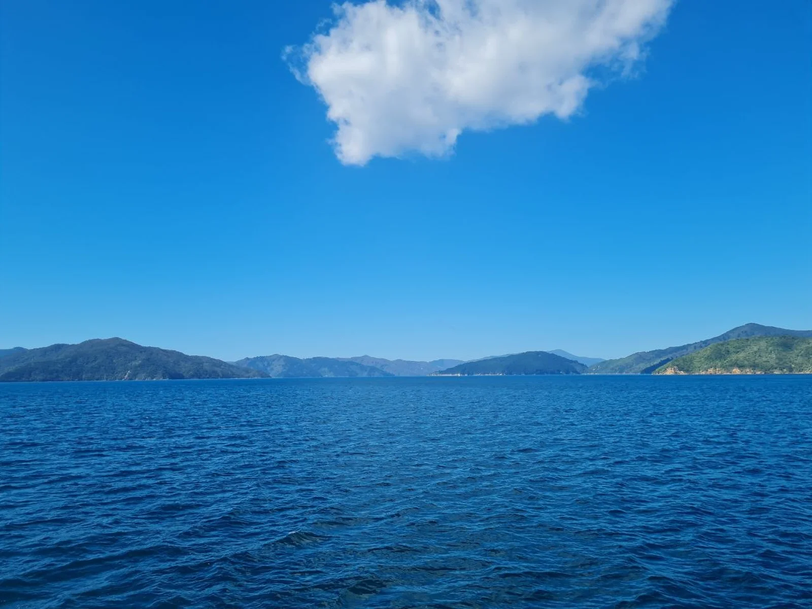
The Queen Charlotte Track runs 73.5 km from historic Ship Cove (Meretoto) to Anakiwa, tracing the coastline of Queen Charlotte Sound in the Marlborough Sounds. The track passes through coastal forest, crosses ridge-tops with views over the sound and Kenepuru Sound, and descends to sheltered bays where boats and lodges dot the shoreline. We hiked it over four days in December 2024, starting with a water taxi from Picton.
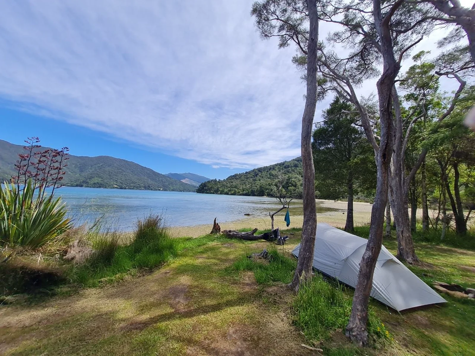
The track was officially opened in 1991 and crosses a mix of public conservation land and private land. A Q.C.T.L.C. pass is required for the private land sections between Kenepuru Saddle and Anakiwa. The track surface is clay-based: firm when dry, slippery after rain. There are no DOC huts along the route; accommodation is camping at DOC campsites or private lodges, with luggage transfer available through walking package operators.
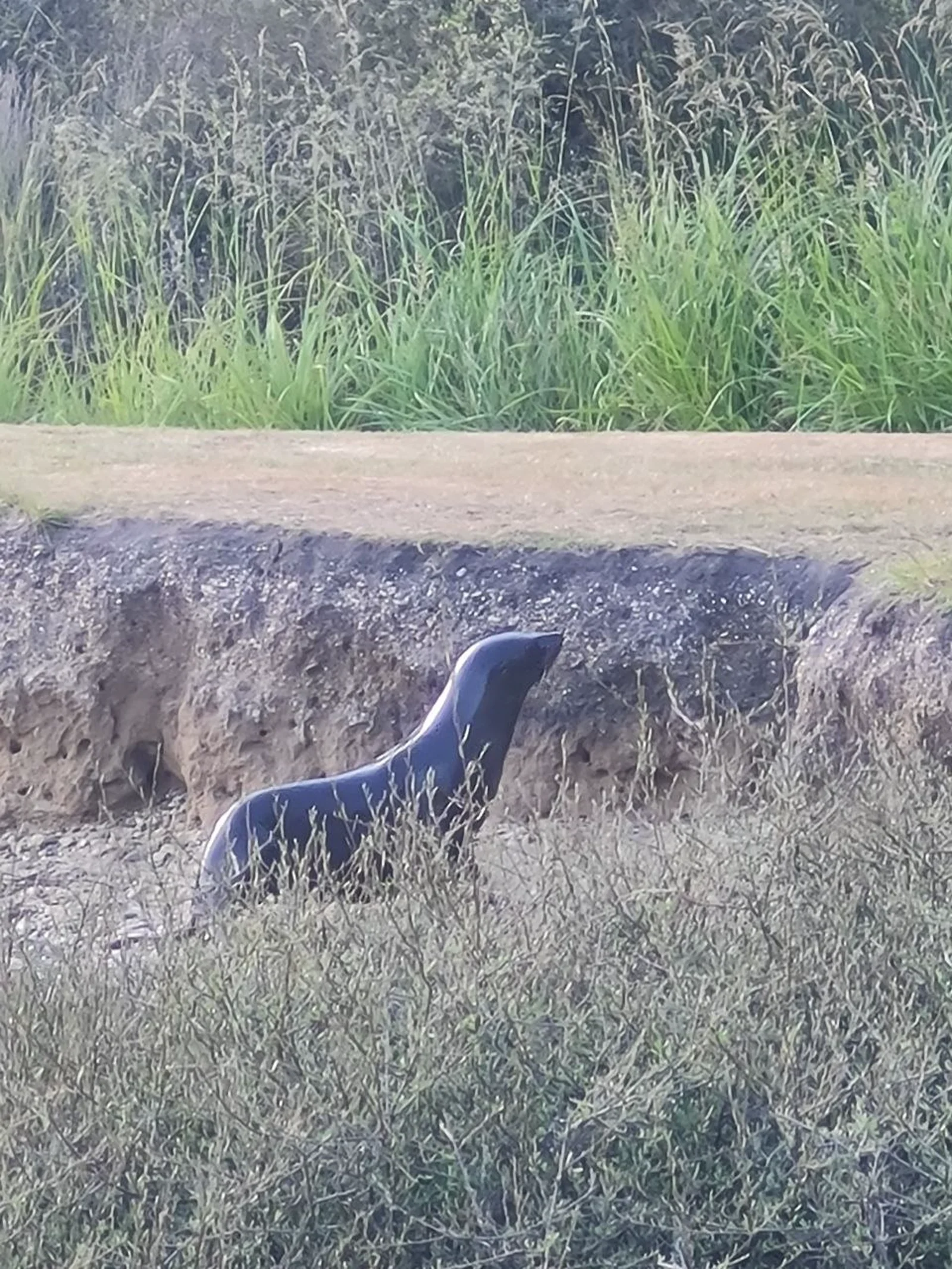
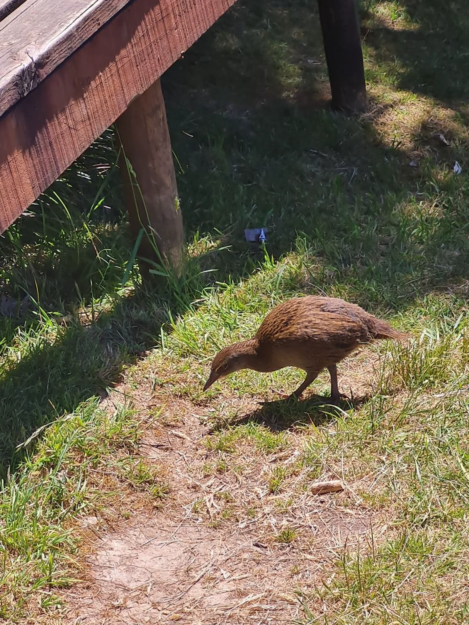
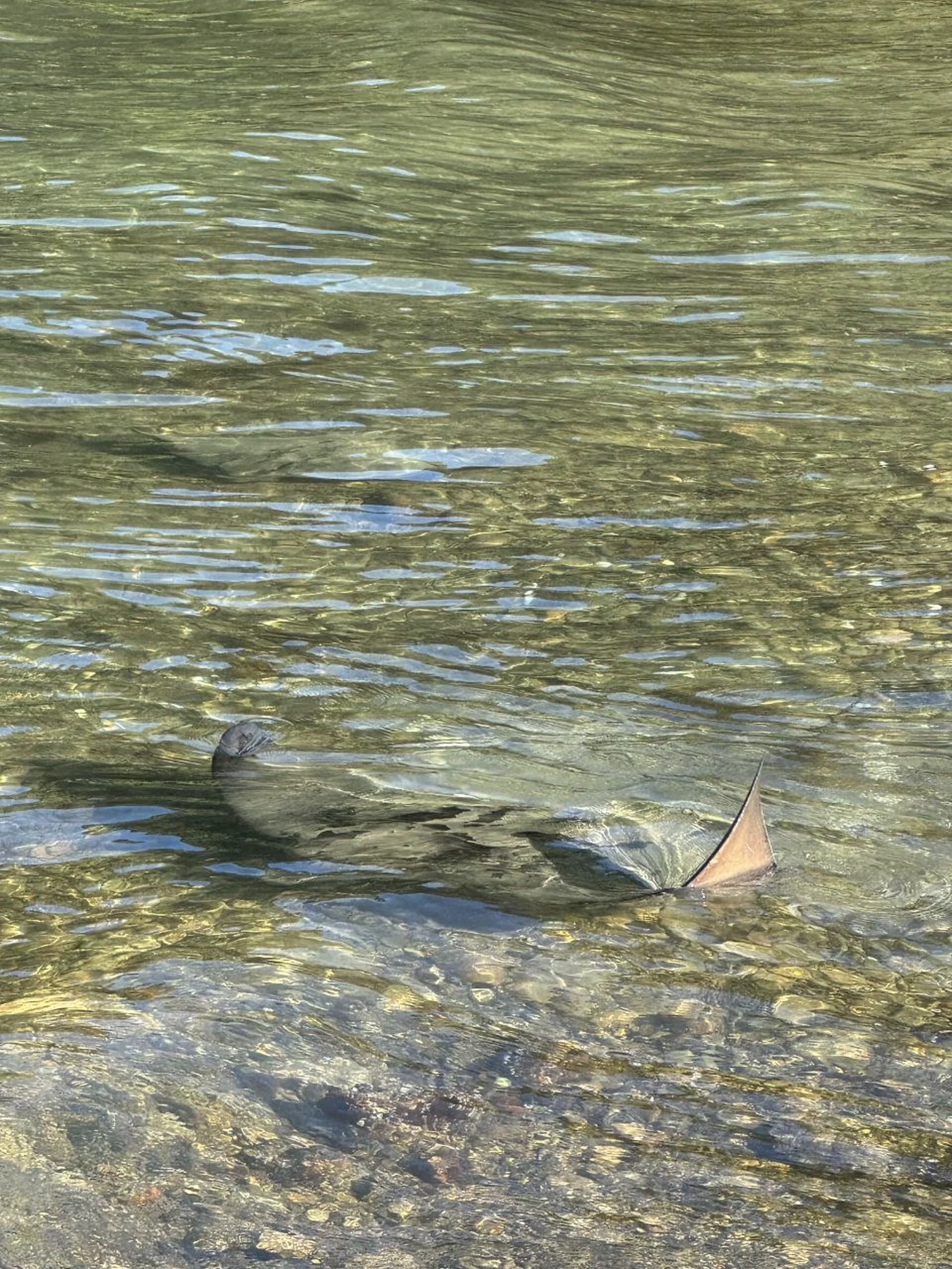
Wildlife is a highlight of the track. Wekas - flightless, curious birds endemic to New Zealand - are a constant presence. They approach campsites and hikers without fear, and watching them forage and interact, especially adults with chicks, is one of the most entertaining aspects of the hike. In the shallow water near the first campsite, we watched a group of five to ten juvenile eagle rays hunting in the bay at dusk. A seal rested near the track side. The forest is alive with bird calls throughout the day.
Transport to and from the track is well-organized and easy to arrange online. Water taxis from Picton reach Ship Cove in about an hour, and a bus or water taxi from Anakiwa returns you to Picton at the end. Water taxis also serve intermediate points along the track, making it easy to shorten individual days.
Day 1 - Ship Cove to Endeavour Inlet
16.0 km | +476 m / -464 m
Starting at historic Ship Cove, where Captain James Cook anchored the Endeavour in 1770, the track climbs through coastal forest to a saddle with views over Resolution Bay. The trail then descends to Endeavour Inlet, passing waterfalls and regenerating bush. At dusk, a group of five to ten juvenile eagle rays hunted in the shallow bay near camp.
Day 2 - Endeavour Inlet to Bay of Many Coves
20.5 km | +810 m / -840 m
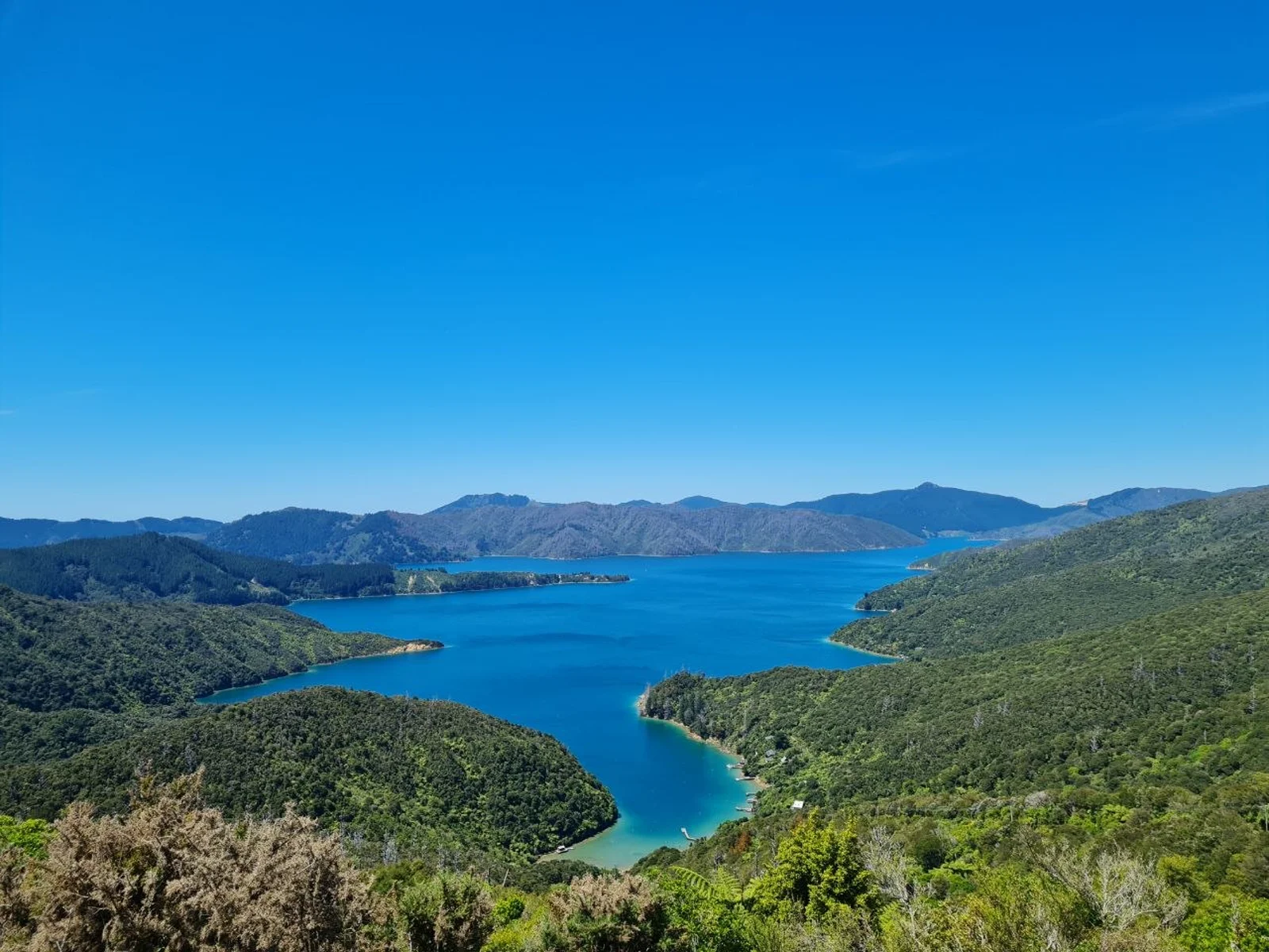
The longest day. The track follows the shoreline of Endeavour Inlet before climbing to the ridge above Camp Bay. From the ridge-top, views open over both Queen Charlotte Sound and Kenepuru Sound. The trail passes through regenerating forest with abundant birdlife.
Day 3 - Bay of Many Coves to Davies Bay
14.8 km | +599 m / -605 m
Continuing along the ridge with constant up and down through native bush, the track descends toward Torea Saddle and Mistletoe Bay. The final stretch follows old bridle paths through coastal forest toward Davies Bay. Water taxis serve Torea Bay and Mistletoe Bay for those wanting to shorten this section.
Day 4 - Davies Bay to Anakiwa
2.5 km | +62 m / -64 m
A short final walk through coastal forest to the trail’s end at Anakiwa. The carpark, shelter, and phone at Anakiwa mark the official terminus of the Queen Charlotte Track.
Getting there
The Queen Charlotte Track starts at Ship Cove (Meretoto), which is accessible only by boat. The gateway town is Picton, on the northern coast of the South Island.
Reaching Picton:
- By ferry: Interislander and Bluebridge ferries connect Wellington (North Island) to Picton in approximately 3 hours.
- By road: Picton is a 25-minute drive from Blenheim, which has the nearest airport (Blenheim Airport, BHE). InterCity buses also serve Picton from Christchurch (about 5.5 hours) and Nelson.
Water taxi to Ship Cove:
- Multiple operators run daily water taxi services from Picton Marina to Ship Cove, taking about 1 hour. The main operators are Cougar Line (cougarline.co.nz), E-Ko Tours (e-ko.nz), and Picton Water Taxis (pictonwatertaxis.co.nz).
- Book online in advance, especially during peak season (December-January).
- The boat trip through the Marlborough Sounds is scenic, with possible wildlife sightings along the way.
Return from Anakiwa:
- A bus service connects Anakiwa to Picton (about 30 minutes). Water taxis also operate from Anakiwa and intermediate points (Mistletoe Bay, Torea Bay) back to Picton.
- Arrange your return transport when booking your outbound water taxi. Most operators offer round-trip packages that include luggage transfer.
Accommodation
There are no DOC huts along the Queen Charlotte Track. Accommodation is either camping at DOC campsites or private lodges.
DOC campsites (six along the route):
- Schoolhouse Bay (near Resolution Bay) - sea level, tent sites, toilets, water
- Camp Bay (Endeavour Inlet) - sea level, tent sites, cooking shelter, toilets, water
- Bay of Many Coves - ridge-top at 305 m, limited tent sites, cooking shelter, toilets, water
- Black Rock - ridge-top at 260 m, limited tent sites, cooking shelter, toilets, water
- Cowshed Bay (near Torea) - sea level, tent sites, toilets, water
- Davies Bay (near Anakiwa) - sea level, tent sites, cooking shelter, toilets, water
Cost: approximately NZ$10-18 per person per night. Book year-round via doc.govt.nz. Campsite tap water is not safe to drink untreated.
Private accommodation along the track includes lodges, cabins, and resorts at Furneaux Lodge (Endeavour Inlet), Punga Cove Resort (Camp Bay), and others. Luggage transfer between accommodation points can be arranged through package operators.
What to bring
- Tent, sleeping bag, and sleeping pad (if camping)
- Water treatment system: filter, tablets, or stove for boiling (giardia risk)
- Q.C.T.L.C. pass for private land sections (purchase at qctlc.com)
- Waterproof jacket and pack cover
- Sturdy hiking boots or trail shoes with good grip
- Sun protection (the Marlborough Sounds can be hot and exposed in summer)
- Insect repellent (wasps are common in late summer and autumn)
- Food for the entire hike (no shops along the track)
- Rubbish bag (pack out all waste, no rubbish facilities at campsites)
Tips
- Book water taxi and campsites well in advance for December-January.
- Wekas are opportunistic food thieves. Secure all food and close zippers on your pack and tent. They will investigate anything accessible.
- Hiking boots with good grip are recommended — the clay-based surface is slippery after rain, especially in spring and autumn.
- Carry enough water for each day. Some ridge sections have limited water sources, especially during dry periods.
- Water taxis serve multiple points along the track. If weather or fatigue is an issue, you can shorten any day by arranging a pickup at the nearest bay.
- No open fires are permitted along the track. Use portable cookers only.
- Check road conditions before travel. Severe weather has damaged some Marlborough Sounds roads in recent years.
Links
- Queen Charlotte Track - Department of Conservation
- Queen Charlotte Track Official Website
- Q.C.T.L.C. Pass - Private Land Access
- DOC Campsite Bookings
- Cougar Line - Water Taxi
- E-Ko Tours - Water Taxi
- Picton Water Taxis
Downloads
Day 1 GPX Day 2 GPX Day 3 GPX Day 4 GPX